Real-time tornado data for the decisions that can't wait
From Tornado Alley outbreaks to isolated supercells, get event-level data on tornado paths, wind bearing, and storm intensity, delivered through one API.
From Tornado Alley outbreaks to isolated supercells, get event-level data on tornado paths, wind bearing, and storm intensity, delivered through one API.


Wikipedia
But this 13-minute window was interrupted in 2021 when a tornado tracked more than 250 miles across four states overnight, in December.* A season and a geography this warning infrastructure simply ignored.
Tornadoes are outgrowing the assumptions we built around them. Ambee's near real-time tornado API brings the reality to you.
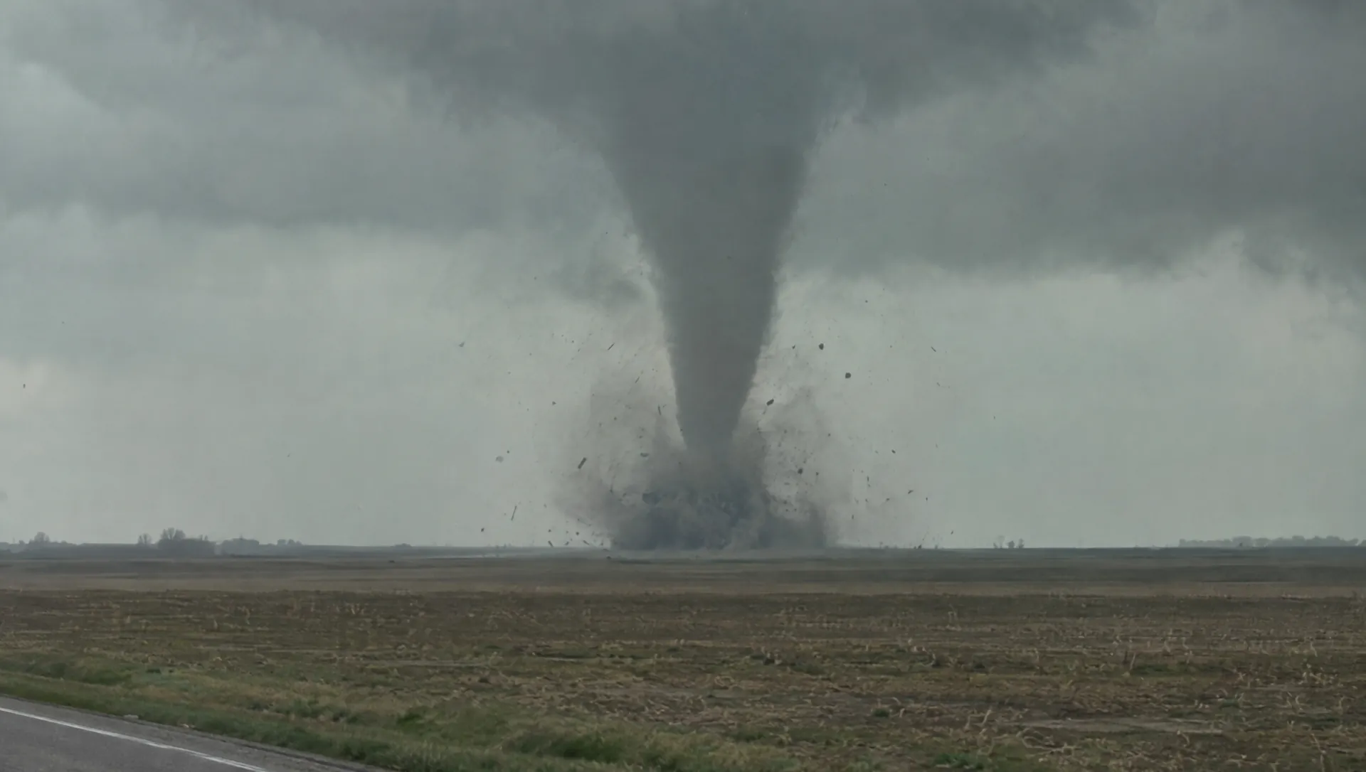

Underwriting teams can use location-specific tornado event history to reprice exposure in geographies that legacy models treat as low-risk. Instead, set premiums that reflect actual storm frequency and path-level severity.

The March 2025 tornado outbreak knocked out power across 26 states in a single multi-day event. Grid operators and utility providers can use real-time storm path data to pre-stage repair crews before it happens.

Real-time tornado event data lets logistics operations reroute shipments, pre-position inventory, and flag at-risk nodes before the disruption compounds into a backlog.

Flattened crops, collapsed silos, and downed irrigation infrastructure: all damages of severe events. Monitor tornado paths against farm locations to trigger loss assessments faster and give agri-operations teams the lead time to protect what remains salvageable.

Ambee delivers storm path and wind severity data at a grid level, while tracking events worldwide.

Visualize tornado risk and severe weather activity directly on your existing maps using Ambee's tile overlays without rebuilding your front end.

Underwriters running loss models, risk teams validating exposure, and planners can construct past tornadoes to stress-test infrastructure against recurrence patterns.

As a NASA PACE Mission partner, Ambee's atmospheric datasets are reinforced by data used by researchers and enterprises tracking severe weather systems globally.


import http.client

conn = http.client.HTTPSConnection("api.ambeedata.com")

headers = {
    'x-api-key': "API_KEY",
    'Content-type': "application/json"
}

conn.request("GET", "/disasters/processed/latest/by-lat-lng?lat=34.94900857016478&lng=141.4&eventType=TC", headers=headers)

res = conn.getresponse()
data = res.read()

print(data.decode("utf-8"))
const http = require('https');
const options = {
method: 'GET',
hostname: 'api.ambeedata.com',
port: null,
path: '/disasters/processed/latest/by-lat-lng?lat=34.94900857016478&lng=141.4&eventType=TC',
headers: {
'x-api-key': 'API_KEY',
'Content-type': 'application/json'
}
};
const req = http.request(options, function (res) {
const chunks = [];
res.on('data', function (chunk) {
chunks.push(chunk);
});
res.on('end', function () {
const body = Buffer.concat(chunks);
console.log(body.toString());
});
});
req.end();OkHttpClient client = new OkHttpClient();
Request request = new Request.Builder()
.url("https://api.ambeedata.com/disasters/processed/latest/by-lat-lng?lat=34.94900857016478&lng=141.4&eventType=TC")
.get()
.addHeader("x-api-key", "API_KEY")
.addHeader("Content-type", "application/json")
.build();
Response response = client.newCall(request).execute();using System.Net.Http.Headers;
var client = new HttpClient();
var request = new HttpRequestMessage
{
Method = HttpMethod.Get,
RequestUri = new Uri("https://api.ambeedata.com/disasters/processed/latest/by-lat-lng?lat=34.94900857016478&lng=141.4&eventType=TC"),
Headers =
{
{ "x-api-key", "API_KEY" },
},
};
using (var response = await client.SendAsync(request))
{
response.EnsureSuccessStatusCode();
var body = await response.Content.ReadAsStringAsync();
Console.WriteLine(body);
}package main
import (
"fmt"
"net/http"
"io"
)
func main() {
url := "https://api.ambeedata.com/disasters/processed/latest/by-lat-lng?lat=34.94900857016478&lng=141.4&eventType=TC"
req, _ := http.NewRequest("GET", url, nil)
req.Header.Add("x-api-key", "API_KEY")
req.Header.Add("Content-type", "application/json")
res, _ := http.DefaultClient.Do(req)
defer res.Body.Close()
body, _ := io.ReadAll(res.Body)
fmt.Println(res)
fmt.Println(string(body))
}<?php
$curl = curl_init();
curl_setopt_array($curl, [
CURLOPT_URL => "https://api.ambeedata.com/disasters/processed/latest/by-lat-lng?lat=34.94900857016478&lng=141.4&eventType=TC",
CURLOPT_RETURNTRANSFER => true,
CURLOPT_ENCODING => "",
CURLOPT_MAXREDIRS => 10,
CURLOPT_TIMEOUT => 30,
CURLOPT_HTTP_VERSION => CURL_HTTP_VERSION_1_1,
CURLOPT_CUSTOMREQUEST => "GET",
CURLOPT_HTTPHEADER => [
"Content-type: application/json",
"x-api-key: API_KEY"
],
]);
$response = curl_exec($curl);
$err = curl_error($curl);
curl_close($curl);
if ($err) {
echo "cURL Error #:" . $err;
} else {
echo $response;
}curl --request GET \
--url 'https://api.ambeedata.com/disasters/processed/latest/by-lat-lng?lat=34.94900857016478&lng=141.4&eventType=TC' \
--header 'Content-type: application/json' \
--header 'x-api-key: API_KEY'require 'uri'
require 'net/http'
url = URI("https://api.ambeedata.com/disasters/processed/latest/by-lat-lng?lat=34.94900857016478&lng=141.4&eventType=TC")
http = Net::HTTP.new(url.host, url.port)
http.use_ssl = true
request = Net::HTTP::Get.new(url)
request["x-api-key"] = 'API_KEY'
request["Content-type"] = 'application/json'
response = http.request(request)
puts response.read_body{
"message": "success",
"hasNextPage": false,
"page": 1,
"limit": 10,
"result": [
{
"event_type": "TC",
"alert_level": null,
"city": "Choshi-shi",
"continent": "asia",
"country_code": "JPN",
"created_time": "2026-06-03 18:56:49",
"date": "2026-05-28 06:00:00",
"details": {
"windspeed": null,
"total_precipitation": null,
"impact": null,
"death": null,
"injured": null,
"affected": null
},
"end_date": null,
"estimated_end_date": "2026-06-07 00:00:00",
"event_id": "08d143483093b45ffd32d2644b7ce69c",
"event_name": "Typhoon Jangmi",
"expiry_time": "2026-06-27 06:00:00",
"lat": 34.94900857016478,
"source_event_id": "EONET_20279",
"state": "Chiba",
"type": "event",
"lng": 141.4,
"proximity_severity_level": "High Risk"
}
]
}Sign up for an Ambee account and generate your API key from the dashboard.
Select the endpoint based on what you need.
Specify the location using latitude and longitude coordinates, ZIP codes, or custom boundaries.
Include your API key in the request header and call the endpoint. You'll receive pollen counts, species-level data, and risk classifications in JSON format.
Real feedback from real innovators












Common questions about Ambee's tornado data
A tornado API delivers tornado event data directly into your software and models. Ambee’s tornado data is part of its Natural Disasters dataset. It’s available through a RESTful API that returns JSON or GeoJSON, and as flat files in CSV and Parquet.
Ambee provides event-level tornado data for any location, including the event name, coordinates, alert level, and a polygon showing the affected or expected affected area. Each event also carries an updated timestamp, an end date, and an estimated end date, so your team can follow an event from onset to close.
Ambee’s natural disaster data refreshes every three hours. This keeps alert levels and affected areas current in your systems while an event is still in progress.
Ambee’s tornado data is available globally, for any location on any landmass. You can query events by latitude and longitude, which lets you check tornado activity against a specific asset or route.
Yes. Ambee’s historical natural disaster records include each event’s dates, alert levels, severity scores, and maximum observed wind speed where available. Underwriters use these records to rebuild past tornado events for loss modeling, and planners use them to test infrastructure against recurrence patterns.
Ambee’s tornado alerts carry an alert level that indicates the event’s intensity. Historical records add severity scores and maximum observed wind speed where available.
Insurers use tornado data to price exposure based on actual event history at each insured location. Historical events help underwriters find risk in areas that older models treat as low-risk. Present event data helps claims teams start loss assessments sooner after a tornado passes.
A tornado warning is a public safety alert issued by a national weather agency, such as the National Weather Service in the United States. Ambee’s tornado data supports business decisions such as rerouting shipments or staging repair crews ahead of disruption. Teams should continue to follow official warnings for any life-safety decision.
Yes. Ambee’s map tiles show natural disaster activity on the maps you already use and work with Mapbox, Leaflet, and OpenLayers. Tiles update hourly, so you can add a tornado layer to your existing dashboards without rebuilding your front end.
Yes. Advertisers use Ambee’s natural disaster data to pause campaigns automatically in affected zones. This keeps brand messaging appropriate during an emergency without manual review.
Tornado Alley is the area of the central and southern Great Plains of the United States, including Texas and Oklahoma, where tornadoes have historically been most frequent. Research covering 1979 to 2017 found tornado frequency declining in parts of this region and rising in parts of the Midwest and Southeast, including the lower Mississippi Valley region often called Dixie Alley.
Sign up for an Ambee account to get your API key, then follow the documentation to make your first request. Ambee’s natural disaster data is also available through data marketplaces, including Databricks and Google Cloud. You can talk to our team about enterprise access or longer historical archives.