The infrastructure behind every dataset Ambee produces
A look at the data infrastructure, methodology, and environmental science behind every dataset Ambee produces.

A look at the data infrastructure, methodology, and environmental science behind every dataset Ambee produces.
Most environmental data is fragmented, inconsistent, and uneven. Making it operationally usable requires solving several problems that most providers leave unaddressed.
Up to 25% of observational and sensor data contains gaps or errors before any processing begins.

Historical and forecast data delivered at different spatial resolutions break the analytical continuity that modeling and trend analysis depend on.

Standard interpolation methods fail to account for terrain, elevation, and spatial heterogeneity, producing outputs that appear smooth but are inaccurate.

Obtaining most data requires navigating fragmented APIs, inconsistent schemas, and variable update schedules.

Satellite and ground feeds deliver raw data. Without calibration, derived fields, and domain-specific processing, it cannot be connected to any business outcome.
Every environmental dataset Ambee produces ingests and processes raw data from multiple sources. Satellites see the whole planet but miss local phenomena. Ground stations are precise but exist only where infrastructure has been built. Models fill coverage gaps but carry systematic biases.
The Ambee Climate Engine draws from all four simultaneously and reconciles them into data that is more accurate than any single source could produce alone.
Global atmospheric coverage
Verified surface observations
Hyperlocal inputs
For ex. GFS, ICON, HRRR, GEM, GEFS
The Ambee Climate Engine takes raw environmental signals across satellites, ground stations, sensor observations, and atmospheric models and turns them into a single, continuously validated dataset. It handles the gaps, the calibration, the schema reconciliation, and the spatial unevenness at the infrastructure level.
The architecture differs depending on the nature of the signal.
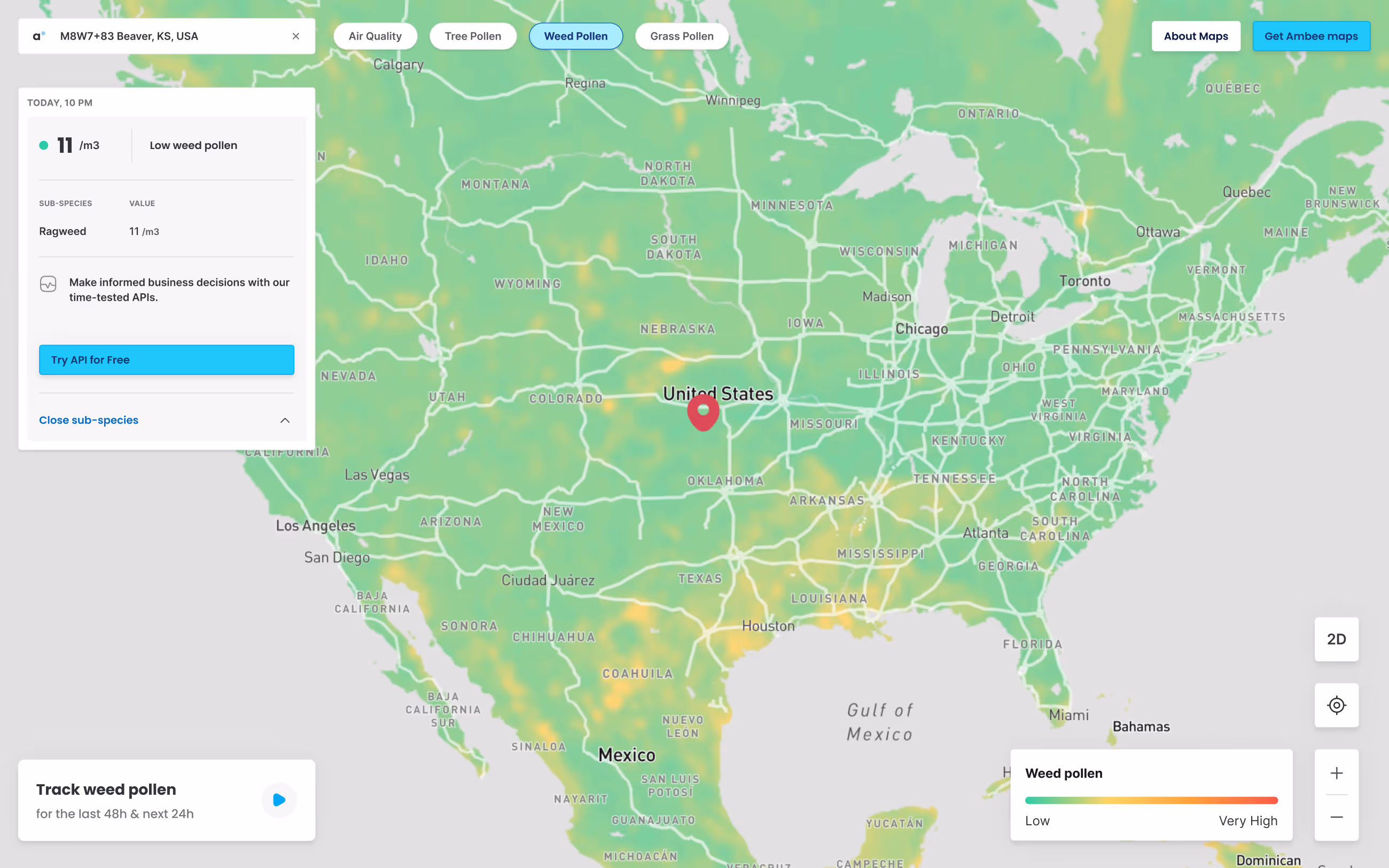
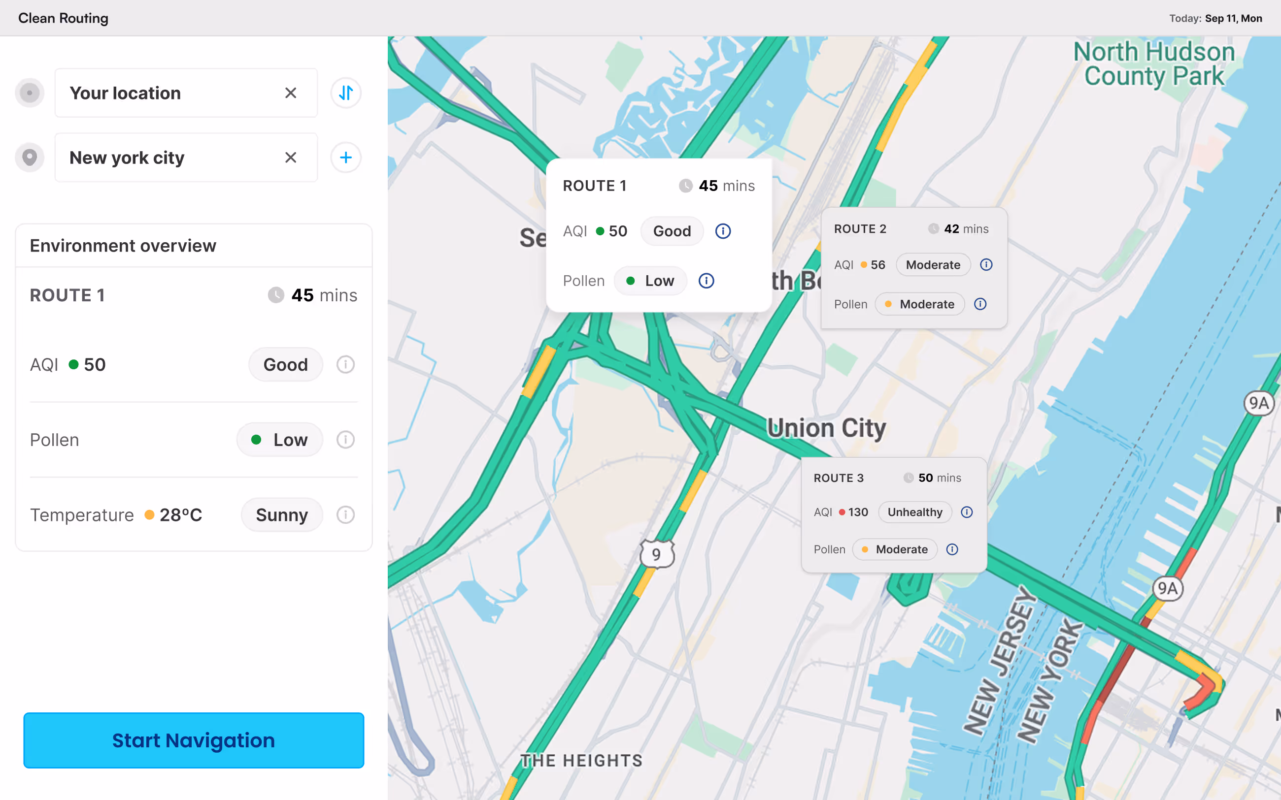
Weather, air quality, and pollen occur everywhere, continuously. For these, Ambee divides the Earth's surface into a consistent spatial grid and interpolates observations into every cell. This lets any location be mapped for climate conditions, whether or not a physical sensor sits nearby.
Raw data is continuously collected from satellites, radar, airport and ground stations, atmospheric models, Ambee's own sensor network, and domain-specific inputs like vegetation cover, emissions, and phenology.
All inputs arrive in different formats, units, and timestamps. This step standardizes everything into a consistent spatial and temporal structure.
Models are trained to fill gaps, correct errors, and reconcile differences between sources, learning relationships like how rain followed by warm temperatures typically triggers a grass pollen surge in that region.
In some cases, region-specific models are trained independently, each learning local climate patterns, vegetation, and seasonal cycles, then combined into a single unified output.
Accuracy is something we take seriously at every step. Outputs are continuously tested against real-world observations, measured across different regions and seasons, and refined over time as new data comes in.
Every dataset is benchmarked against independent ground-truth observations, reference-grade monitoring networks, and leading third-party datasets. Detailed benchmark reports are available on request.
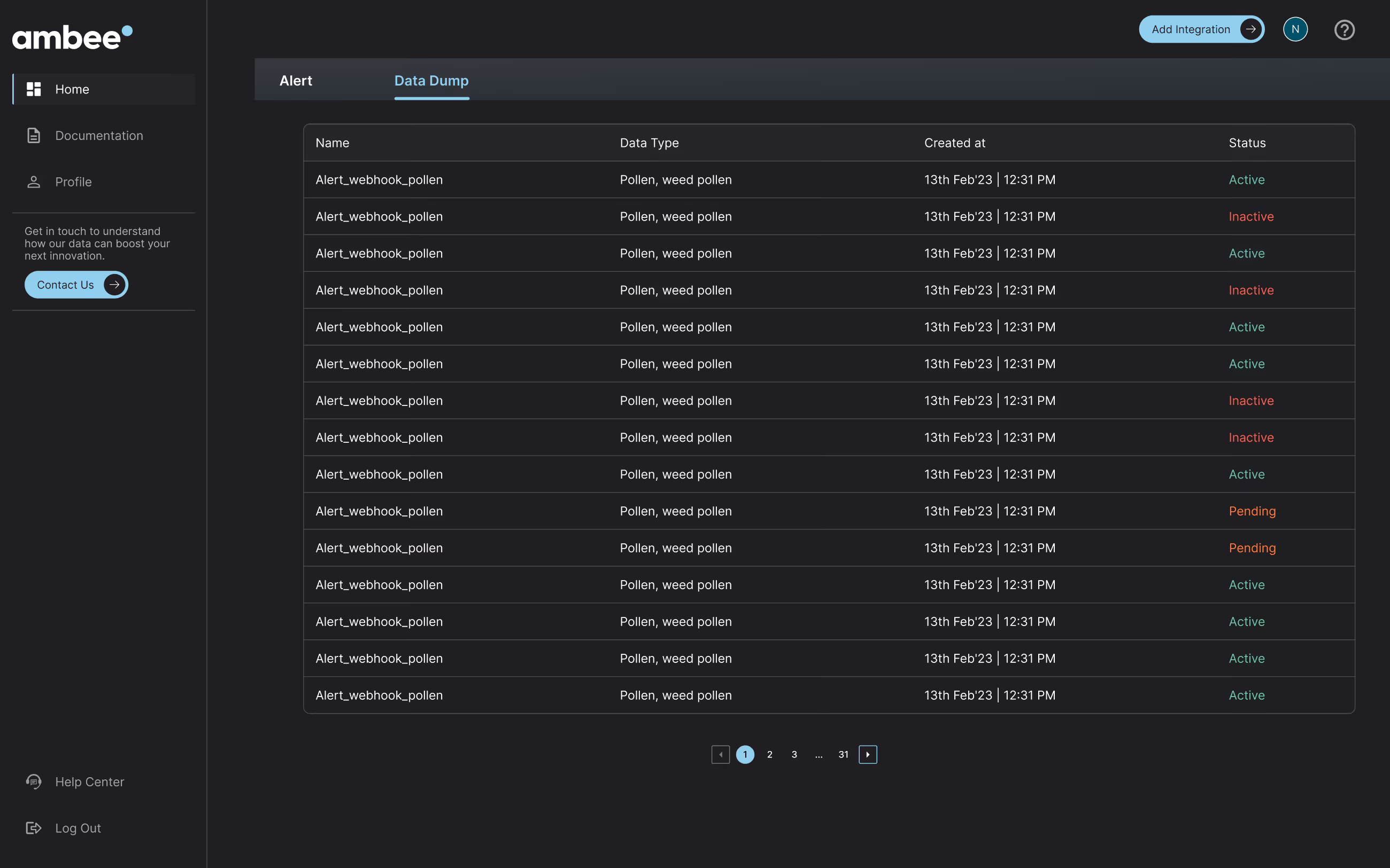
Some datasets, like natural disasters and wildfires, are event-driven. Here, the pipeline ingests reports in near real time, removes stale events, and ensures all events are spatially accurate and temporally fresh.
Incidents are detected from satellites and/or reported feeds simultaneously and cleaned on arrival. Each event is logged with coordinates, timestamp, source, and a confidence signal.
The same incident typically arrives from ten or more sources with different formats and schemas. Each source is standardized independently, then merged into a single coherent record.
All outputs are validated before delivery. Geospatial boundaries are checked and corrected where needed. For Influenza-like Illness, data is tested against official incidence reports to confirm accuracy across regions.
All ingestion sources are monitored continuously. Automated alerts trigger on any source failure, and backup feeds ensure data availability is maintained without interruption.
.svg)
Ambee is the only non-academic partner on NASA's PACE mission, launched in 2024, gaining early access to hyperspectral aerosol data that is integrated directly into the Ambee Climate Engine

Atmospheric and reanalysis models, including GFS, ICON, ECMWF, ERA5, and CFSR, satellite imagery, radar, ground and airport observations.


The Ambee Climate Data Suite is designed to fit into any existing workflow.
The Ambee Climate Engine powers more than datasets. Purpose-built products connect climate intelligence directly to business operations.
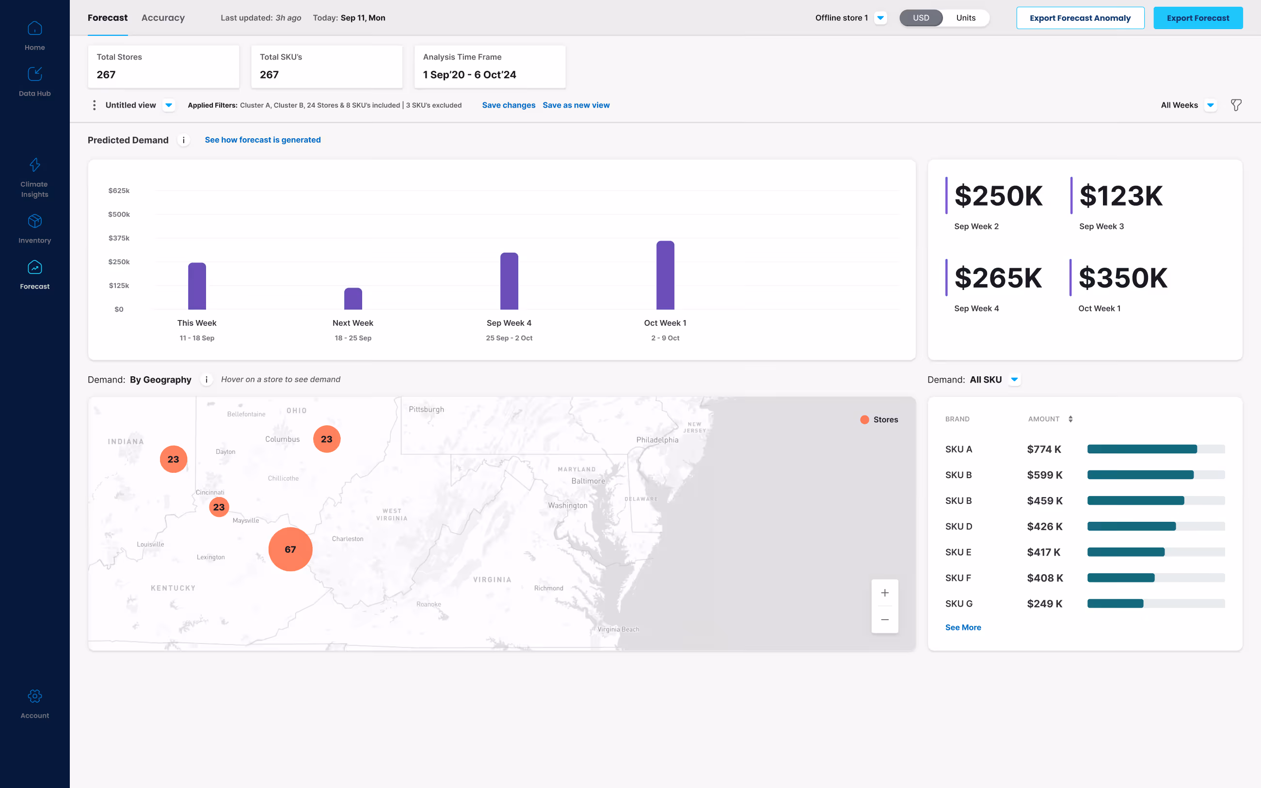
ClimaChain connects climate signals to inventory, supply chain, and commercial planning, helping teams forecast more accurately and act earlier.
API documentation, coverage maps, and sample datasets are available for every product in the Ambee catalog.