


Data sources

Below is a list of satellite and station sources we use from different countries
Argentina: https://www.buenosaires.gob.ar/
Bosnia: https://monitoringzrakatk.info/
Canberra: https://www.data.act.gov.au
Chile: https://sinca.mma.gob.cl
CPCB: https://cpcb.nic.in/
EEA: https://www.eea.europa.eu/
ESA Copernicus: https://www.copernicus.eu/en
Hong Kong: https://www.aqhi.gov.hk
Indonesia: https://www.bmkg.go.id
Israel: https://air.sviva.gov.il/
London Air: https://www.londonair.org.uk/LondonAir/Default.aspx
Montenegro: https://www.epa.org.me
NASA Earth Data: https://www.earthdata.nasa.gov/
Northern Territory: https://ntepa.nt.gov.au/
Norway: https://nilu.no/
NSW: https://www.dpie.nsw.gov.au
Ontario: https://www.ontario.ca/page/ministry-environment-conservation-parks
Philippines: https://emb.gov.ph/
Queensland: https://www.qld.gov.au/environment
Rwanda: https://www.rema.gov.rw/home
Serbia: https://sepa.gov.rs
South Africa: https://saaqis.environment.gov.za
South Australia: https://www.epa.sa.gov.au
South Korea: https://www.airkorea.or.kr
Stockholm: https://www.scb.se/
Taiwan: https://airtw.epa.gov.tw
Tasmania: https://epa.tas.gov.au/ : https://creativecommons.org/licenses/by-sa/4.0/
Thailand: http://air4thai.pcd.go.th
Turkey: https://sim.csb.gov.tr
UAE: https://www.adairquality.ae/
UK: https://uk air.defra.gov.uk
USEPA: https://www.epa.gov/
Victoria: https://www.epa.vic.gov.au/
Western Australia: der.wa.gov.au/
Make better decisions with science-backed unimpeachable data


Accurate
The best of ML and climate science to provide you with optimum spatial and temporal resolution, coupled with verified accuracy.


Actionable
Complex environmental data turned into relevant and actionable information to improve decisions across sectors.


Adaptable
Easy-to-integrate APIs built based on developers’ needs, suitable for any program, application or product.
Globally accepted, USEPA, NAB-compliant data delivered through easy-to-integrate APIs

Air Quality
Understand and predict air pollution trends anywhere in the world.


pollen
Track pollen levels to protect health and optimize allergy-driven decisions.


weather
Access precise weather insights to plan, forecast, and adapt operations.


wildfire
Monitor fire activity and predict risks for safer, smarter responses.


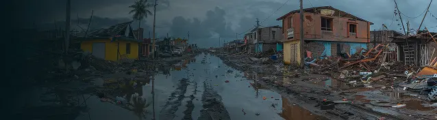
natural disaster
Detect and prepare for storms, floods, and extreme events in real time.

Influenza-like Illness
Anticipate flu trends and improve population health outcomes.

.png)
