Real-time landslide data that bridges onset and response
Monitor slope failures and ground movement events globally through event-level data delivered via a single API, refreshed every 6 hours
Monitor slope failures and ground movement events globally through event-level data delivered via a single API, refreshed every 6 hours


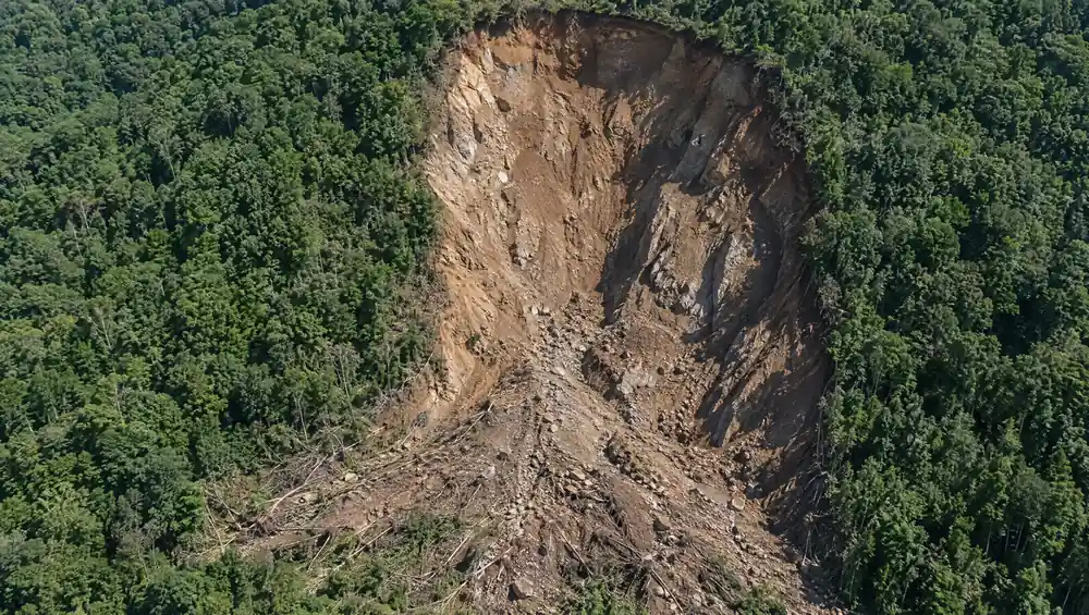
10,000 years to prepare and less than a minute to arrive. Landslides are a devastating reminder of what happens when the Earth finally gives way.
Research Gate
In the face of such sudden destruction, response depends on visibility.
Ambee's Landslide API is the structured feed of global slope failure events that, refreshed every 6 hours.

A percentage of the world's road area sits in high landslide-risk terrain. Engineers need real-time event feeds paired with historical recurrence to prioritize the slopes that fail repeatedly.

Standard property policies exclude landslide damage almost universally. Multi-year event histories tied to specific coordinates let underwriting teams price coverage on actual slope behavior.

Continuous event monitoring across adjacent natural terrain flags movement that can destabilize the asset, so safety officers can clear a haul road before a shift rotation begins.

Reservoir filling can reactivate ancient landslides on the slopes above the water. Tracking slope events upstream of a reservoir and across the catchment lets operators correlate drawdown decisions with slope behavior.

Track slope failures and ground movement across mountain, monsoon-fed slopes, hillsides, and post-glacial valleys worldwide.

Ambee is an early adopter of NASA's PACE mission, which delivers hyperspectral data used across Ambee's climate intelligence work.

Two months of historical events alongside access to 6 months of data and over 30 years of bulk data upon custom request.

Pull landslide data straight into existing workflows in JSON, CSV, Parquet, Excel, or XML. No specialized geological background required to read what comes back.


const http = require("https");

const options = {
	"method": "GET",
	"hostname": "api.ambeedata.com",
	"port": null,
	"path": "/disasters/latest/by-lat-lng?lat=37.7823&lng=-122.3912&eventType=LS",
	"headers": {
		"x-api-key": "API_KEY",
		"Content-type": "application/json"
	}
};

const req = http.request(options, function (res) {
	const chunks = [];

	res.on("data", function (chunk) {
		chunks.push(chunk);
	});

	res.on("end", function () {
		const body = Buffer.concat(chunks);
		console.log(body.toString());
	});
});

req.end();
const http = require("https");
const options = {
"method": "GET",
"hostname": "api.ambeedata.com",
"port": null,
"path": "/disasters/latest/by-lat-lng?lat=37.7823&lng=-122.3912&eventType=LS",
"headers": {
"x-api-key": "API_KEY",
"Content-type": "application/json"
}
};
const req = http.request(options, function (res) {
const chunks = [];
res.on("data", function (chunk) {
chunks.push(chunk);
});
res.on("end", function () {
const body = Buffer.concat(chunks);
console.log(body.toString());
});
});
req.end();const http = require("https");
const options = {
"method": "GET",
"hostname": "api.ambeedata.com",
"port": null,
"path": "/disasters/latest/by-lat-lng?lat=37.7823&lng=-122.3912&eventType=LS",
"headers": {
"x-api-key": "API_KEY",
"Content-type": "application/json"
}
};
const req = http.request(options, function (res) {
const chunks = [];
res.on("data", function (chunk) {
chunks.push(chunk);
});
res.on("end", function () {
const body = Buffer.concat(chunks);
console.log(body.toString());
});
});
req.end();const http = require("https");
const options = {
"method": "GET",
"hostname": "api.ambeedata.com",
"port": null,
"path": "/disasters/latest/by-lat-lng?lat=37.7823&lng=-122.3912&eventType=LS",
"headers": {
"x-api-key": "API_KEY",
"Content-type": "application/json"
}
};
const req = http.request(options, function (res) {
const chunks = [];
res.on("data", function (chunk) {
chunks.push(chunk);
});
res.on("end", function () {
const body = Buffer.concat(chunks);
console.log(body.toString());
});
});
req.end();const http = require("https");
const options = {
"method": "GET",
"hostname": "api.ambeedata.com",
"port": null,
"path": "/disasters/latest/by-lat-lng?lat=37.7823&lng=-122.3912&eventType=LS",
"headers": {
"x-api-key": "API_KEY",
"Content-type": "application/json"
}
};
const req = http.request(options, function (res) {
const chunks = [];
res.on("data", function (chunk) {
chunks.push(chunk);
});
res.on("end", function () {
const body = Buffer.concat(chunks);
console.log(body.toString());
});
});
req.end();<?php
$curl = curl_init();
curl_setopt_array($curl, [
CURLOPT_URL => "https://api.ambeedata.com/disasters/latest/by-lat-lng?lat=37.7823&lng=-122.3912&eventType=LS",
CURLOPT_RETURNTRANSFER => true,
CURLOPT_ENCODING => "",
CURLOPT_MAXREDIRS => 10,
CURLOPT_TIMEOUT => 30,
CURLOPT_HTTP_VERSION => CURL_HTTP_VERSION_1_1,
CURLOPT_CUSTOMREQUEST => "GET",
CURLOPT_HTTPHEADER => [
"Content-type: application/json",
"x-api-key: API_KEY"
],
]);
$response = curl_exec($curl);
$err = curl_error($curl);
curl_close($curl);
if ($err) {
echo "cURL Error #:" . $err;
} else {
echo $response;
}curl --request GET \
--url 'https://api.ambeedata.com/disasters/latest/by-lat-lng?lat=37.7823&lng=-122.3912&eventType=LS' \
--header 'Content-type: application/json' \
--header 'x-api-key: API_KEY'url = URI("https://api.ambeedata.com/disasters/latest/by-lat-lng?lat=37.7823&lng=-122.3912&eventType=LS")
http = Net::HTTP.new(url.host, url.port)
http.use_ssl = true
request = Net::HTTP::Get.new(url)
request["x-api-key"] = 'API_KEY'
request["Content-type"] = 'application/json'
response = http.request(request)
puts response.read_body{
"message": "success",
"hasNextPage": false,
"page": 1,
"limit": 10,
"result": [
{
"event_type": "LS",
"alert_level": null,
"city": "Glan",
"continent": "asia",
"country_code": "PHL",
"created_time": "2026-06-08 00:48:57",
"date": "2026-06-07 23:38:00",
"details": {
"magnitude": 7.8,
"depth": 63,
"waveheight": null,
"impact": null,
"death": null,
"injured": null,
"affected": null
},
"end_date": null,
"estimated_end_date": "2026-06-08 00:00:00",
"event_id": "d44292b2a11f73f0e2bd6fa0ff159f40",
"event_name": "landslide at in Mindanao, Philippine Islands",
"expiry_time": "2026-07-07 23:38:00",
"lat": 5.7,
"source_event_id": "noasu_tgacbc",
"state": "Soccsksargen",
"type": "event",
"lng": 125.2,
"proximity_severity_level": "High Risk"
}
]
}
Sign up for an Ambee account and generate your API key from the dashboard.
Select the endpoint based on what you need.
Specify the location using latitude and longitude coordinates, ZIP codes, or custom boundaries.
Include your API key in the request header and call the endpoint. You'll receive pollen counts, species-level data, and risk classifications in JSON format.
Real feedback from real innovators












Monitor developing storm systems to stay ahead of severe weather.

Track present and forecast temperature conditions across any location.

Get present tornado tracking to support faster, safer decisions.

Follow hurricane formation and movement to plan around coastal risk.

Follow cyclone formation and movement to plan around regional risk.

Monitor seismic activity as it happens to assess exposure.

Track how severe storms increase rainfall-driven erosion and terrain instability.
Track how severe storms increase rainfall-driven erosion and terrain instability.

Monitor flood risk as conditions develop to protect people and assets.

Track how severe storms increase rainfall-driven erosion and terrain instability.

Track how severe storms increase rainfall-driven erosion and terrain instability.

Common questions about Ambee's landslide data
The Ambee landslide API delivers early warnings, terrain movement data, and real-time updates for landslide-prone areas, empowering organizations to mitigate risks and enhance safety protocols.
Data is refreshed every 6 hours, providing near real-time insights into terrain shifts and potential landslide risks.
Our landslide API offers global coverage, including high-risk mountainous regions, coastal areas, and urban zones susceptible to landslides.
Yes! The API provides up to 2 months of historical landslide data. Upon custom request, you can access up to 6 months of data, and bulk data is available for over 30 years.
For seamless integration, use our detailed landslide API documentation, Postman guides, and developer dashboard. Sample codes and tutorials are also provided.
Yes. Retrieve landslide data by coordinates, date range, terrain type, or risk level for targeted analysis.
Ambee ensures the accuracy and reliability of landslide data through a multi-model approach to data collection. The data is then analyzed using proprietary AI and ML models.
Landslide data is available in JSON, CSV, Excel, Parquet, and XML formats for seamless integration into your systems.